

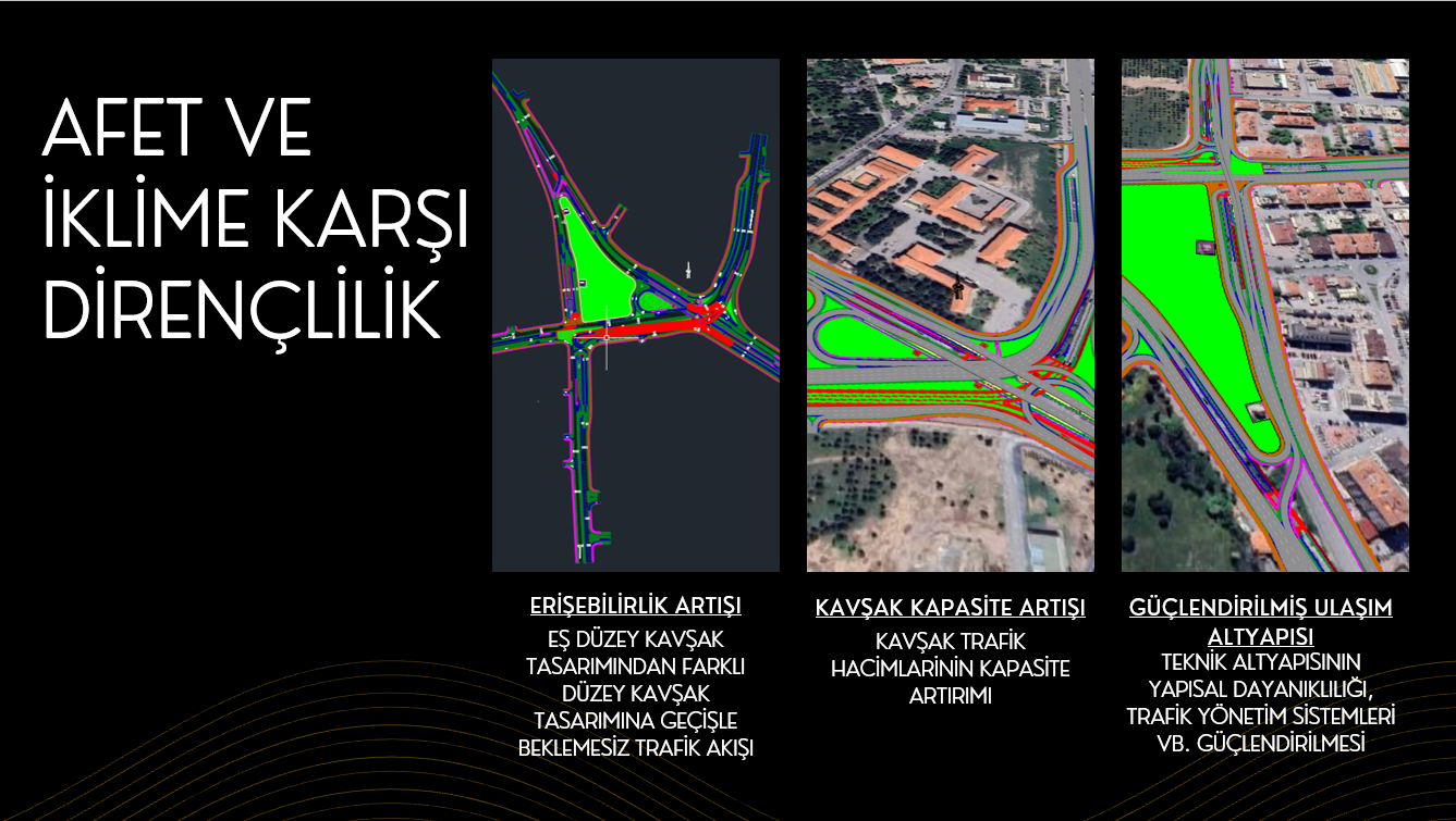
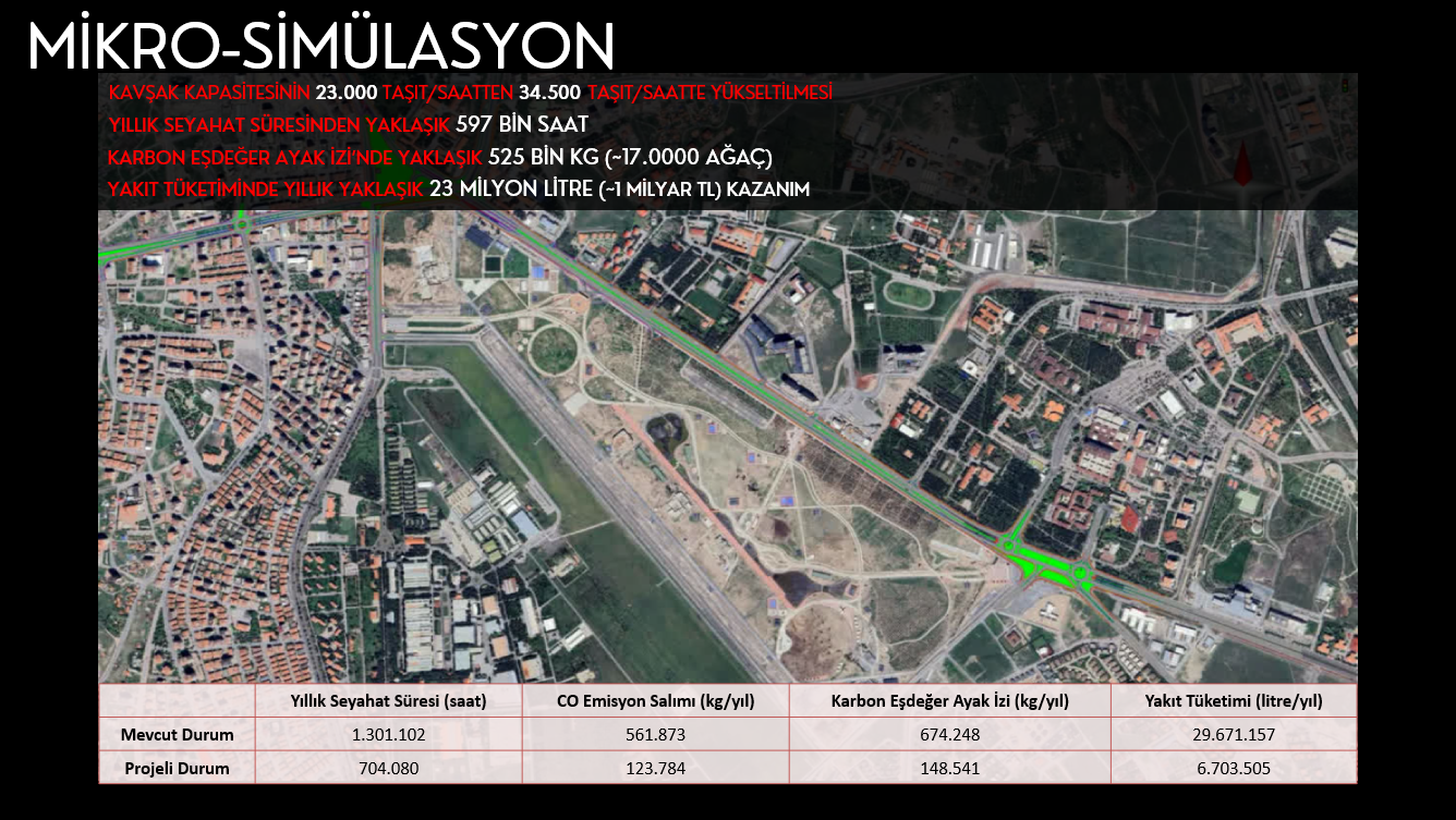
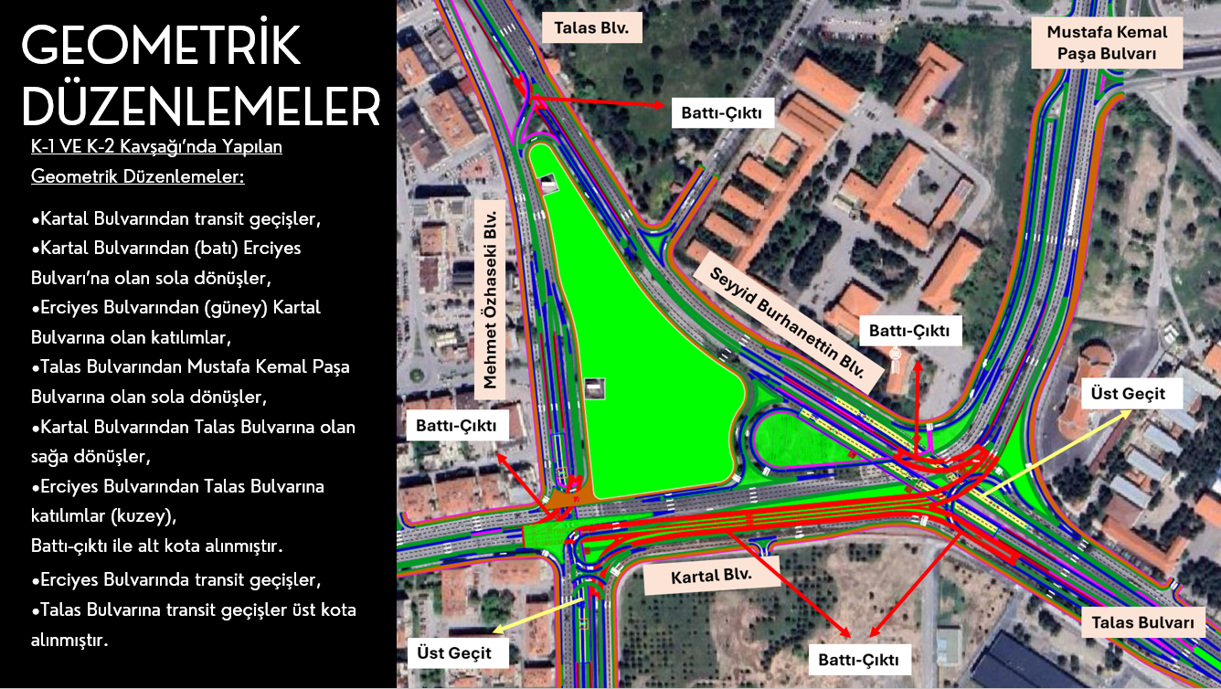
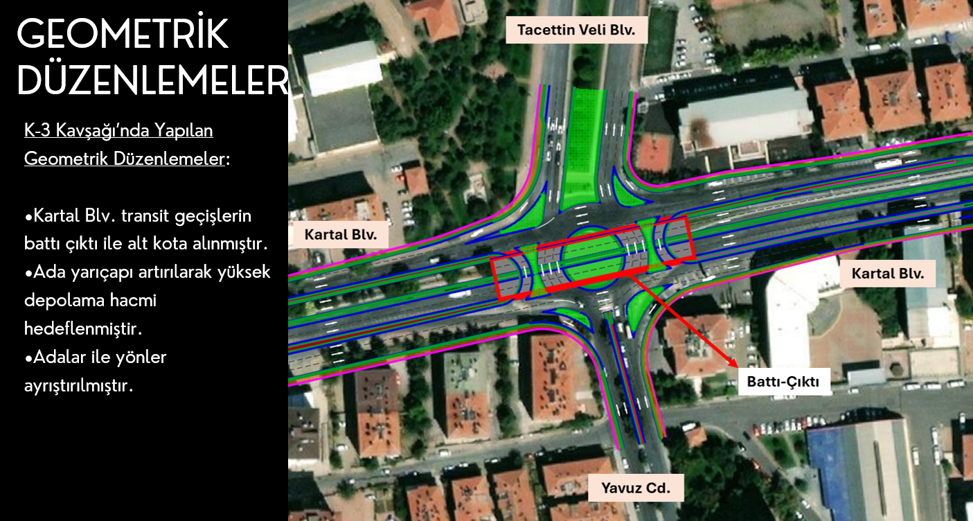
In central Kayseri, the Mustafa Kemal Paşa, Mehmet Özhaseki, Talas, Seyyid Burhaneddin and Kartal boulevards are designated evacuation corridors for disaster and emergency scenarios. The work set out to improve access along these routes, make the urban transport network more resilient to disasters and keep traffic moving without interruption. Geometric improvements at junctions, grade-separated junction designs and micro-simulation were used to raise junction capacity, cut journey times and fuel consumption, lower the carbon footprint and strengthen traffic management systems.
The project aims to give Kayseri a transport network that is resilient to disasters, accessible and sustainable.
City: Kayseri
Country: Türkiye
Client: Kayseri Metropolitan Municipality
Project Period: 2023-2024
Scope of Work: Baseline analysis of junctions along the disaster evacuation corridors, traffic simulation, grade-separated junction designs to increase capacity, geometric improvements, and environmental and operational benefit analysis.